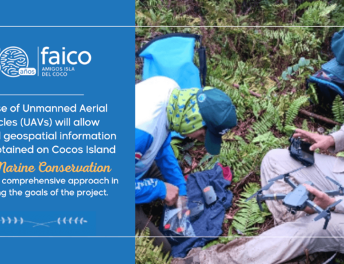
- The Project aims to demonstrate connectivity between Cocos Island and Golfo Dulce.
- Satellite technology allows knowing the trajectory, temperature of the waters, and the depth at which different species of sharks swim.
San José, July 23rd 2019.
Cocos Island National Park (CINP) has important animal aggregation areas (cleaning stations and breeding and feeding grounds) that represent a “protected oasis” for migratory marine species. However, many of these species that visit the island use coastal waters as breeding grounds, which are more vulnerable to extraction pressures, pollution, and the degradation of the natural habitat.
In May 2018, the project “Investigation and conservation of migratory sharks in Cocos Island National Park” began. It consists on tagging sharks in Cocos Island and Golfo Dulce National Park using satellite tags, a methodology that allows better understanding the migration and interrelations of this species. This satellite shark tagging project is the largest one carried out to date on Cocos Island.
The results of the project aim to characterize the migratory behavior of several shark species that use waters surrounding Cocos Island and Golfo Dulce National Park, as well as proposing strategies or recommendations that promote the conservation of sharks and their essential habitats.
“Due to its status as an oceanic island, CINP is considered worldwide as a natural laboratory. For the Cocos Marine Conservation Area (ACMC), it is of utmost importance to carry out this type of research that generates such relevant data at the level of conservation and management of these species. Likewise, they allow the direct involvement and participation of our park rangers, together with strategic public-private actions,” said Gina Cuza, Regional Director a.i. of the ACMC.
This project grew out of the cooperation initiative of the Thyssen-Bornemisza Art Contemporary Academy (TBA21-ACADEMY), the support of the Friends of Cocos Island Foundation (Faico), and the conceptualization of the Misión Tiburón Conservation Association on the connectivity of these species in coastal and oceanic habitats, as a result of research conducted in partnership with the Cocos Marine Conservation Area.
How does tagging work?
Satellite tagging allows tracking individuals during a specified period. When they surface, individuals send a signal and are located by a satellite system, similar to GPS (Global Positioning System). Thus, the paths through which the individuals are moving are tracked. It is then possible to create maps with the routes traveled during the total transmission period.
In addition, they have the ability to record information and see how they move on the surface or in the water column, at what depths, how long are they in each place and at what temperature. It is quite accurate information that will allow us to characterize how various pelagic species use the habitat.
For Ilena Zanella, Executive Director of Misión Tiburón “if we want to guarantee the sustainability of migratory species that visit Cocos Island, it is essential to identify new critical habitats, such as breeding, feeding, and reproduction grounds, and thus promote the protection of the entire life cycle of these species, threatened by human actions once they leave the protected waters of Cocos Island.”
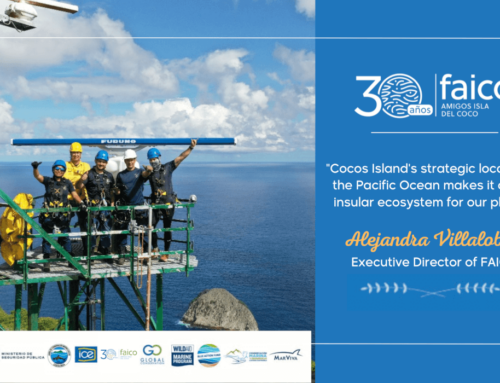
“Sharks play a crucial role in balancing marine ecosystems. They contribute to the health of reefs, and their beauty attracts tourists from around the world. Projects like these allow us to generate very valuable information about this species, its paths, and the characteristics of its habitats. In addition, it consolidates public-private partnerships aimed at research for the benefit of this World Heritage Site and the Marine Corridor of the Eastern Tropical Pacific Ocean,” said Alejandra Villalobos, Executive Director of Faico.
To date, a total of four shark tagging trips have been made, two to Cocos Island National Park and two to Golfo Dulce. The species with the highest number of tags placed (eight) was the silky shark; followed by the tiger shark, and the hammerhead shark, with five tags each.
The project has financial support from i) TBA21-Academy, which supports artists, scientists, and thought leaders on collaborative discovery expeditions. It is dedicated to fostering a deeper understanding of the ocean through the lens of art and by generating creative solutions to its most pressing problems, and ii) Alligators Head Foundation, a non-profit environmental NGO that is responsible for the conservation and management of the East Portland Fish Sanctuary in Jamaica.


