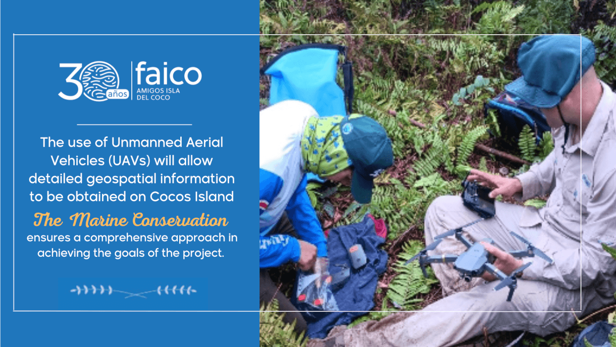
The use of Unmanned Aerial Vehicles (UAVs) will allow detailed geospatial information to be obtained on Cocos Island, marking an innovative phase in the conservation of the unique ecosystems of this National Park.
The participation of academic institutions, state institutions and organizations dedicated to marine conservation ensures a comprehensive approach in achieving the goals of the project.
The Friends of Cocos Island Foundation (FAICO), the Cocos Marine Conservation Area (ACMC-SINAC), together with the School of Geography (EG-UCR), the School of Topographic Engineering (EIT-UCR) and the National Laboratory of Materials and Structural Models (Lanamme-UCR) have joined forces to work on the generation of geospatial information of Cocos Island through photogrammetric and LIDAR technologies.
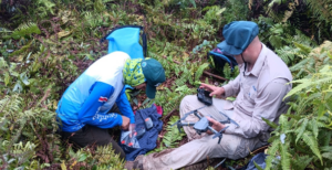
The objective of the project is to generate detailed geospatial information on relief, hydrology, land use, vegetation cover and other information of interest that contributes to the efficient planning and management of natural resources. For this, Unmanned Aerial Vehicles (UAVs) are used, which allow this data to be obtained about the island.
The integration of specialized knowledge from areas such as Geography, Remote Surveying, Topographic Engineering and Geographic Information Systems (GIS) allows for a more complete and comprehensive understanding of ecosystems and their dynamics. For this reason, in March 2023, SINAC formally requested the support and participation of Lanamme-UCR due to its extensive experience. Subsequently, the Schools of Geography and the School of Topographic Engineering joined forces to strengthen the project.

This data will be essential because for the first time it will be possible to have highly detailed aerial photographs, something that will improve informed decision-making about the management of the natural resources and ecosystems present on Cocos Island.

